Corner Country, Innamincka & the Flinders Ranges
by David Cook
Day 1 – Friday, May 9
Leave home at 10.30am, David (me) and Jan in the Pajero, James (son) and Megan
(his partner) in his Landy TD5, after two weeks of frantic preparations and
several months of close planning. Camper packed, water tank filled to the brim.
Seemed this day would never come. A leisurely drive over the Blue Mountains to
Forbes, 382km away, where Jan has a relative. We get to sleep in normal beds,
have regular showers and eat at a table, all for the last time for two glorious
weeks.
Day 2 – Saturday
May 10
Leave Forbes at 8.30am and head up through Bogan Gate, through the beautiful
little town of Trangie to Nyngan, asphalt all the way except for a 10km stretch
of dirt where the road was being widened. Stop on the bank of the Bogan River at
Nyngan for morning coffee and muffins, courtesy of Megan, then on to Cobar where
we refuel after 383km. The V6 petrol Pajero pulling the estimated 1000kg of
camper is averaging 14.83 litres per 100km on these long flat sections, while
James’ Td5 Landy (with no trailer) is getting 9.4 litres per 100km.. Just out of
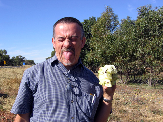
Cobar we stop to satisfy James and Megan’s curiosity about paddymelons growing
along the road. To satisfy curiosity I split one open and taste it – wish I
hadn’t! I’ve still got the taste in my mouth. Continue the long drive to
Wilcannia, stopping to check that there’s actually water in the Darling (still
pretty low), then head up to White Cliffs, arriving at 5.30pm after 748km to
meet our friends Phil and Lyn, from Adelaide, with their Nissan and his
home-built/rebuilt pop-top camper. Camp ground is basic but it has all we need
and is right on the edge of town, in Johnston Street. A riotous evening at our
first camp, too much to drink and good food. Fall into bed exhausted after a
total of 748 km for the day.
Day 3 – Sunday, May
11
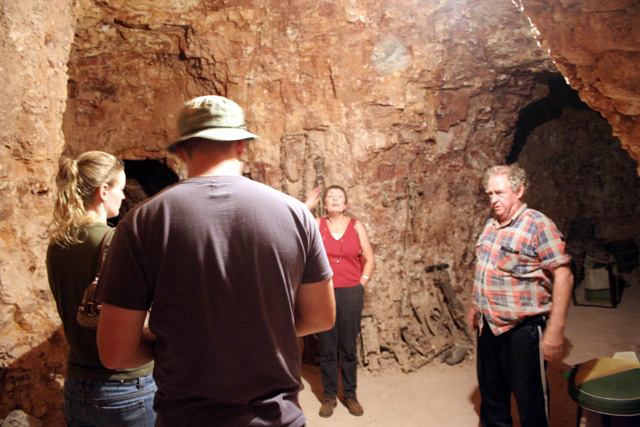
Drive around White Cliffs, checking out some of the mines, the great Otto Photo
Gallery, crazy Jock’s mine tour (worth the $5 a head just for the fun of seeing
Jock and hearing his wild stories). We have lunch at the local Sports Club at
the Mothers Day banquet being laid on by the local miners - have a great time
amongst the locals, and $10 a head for a good salad meal. A morning well spent.
After staying for the speeches we leave and head to the fuel depot to top up the
tanks and the jerry cans, then head out of town for Mutawintji National Park,
half way to Broken Hill. The road is full of bulldust and pretty rough in
places, but we arrive okay after 157km, with a collection of wood picked up on
the way for a fire. Set up camp at the Homestead Creek camp ground, about 5km
inside the park entrance. Well water and long drop toilets, but hot showers make
up for just about anything. We have a good feed and settle down for a few quiet
drinks around the campfire before retiring.
Day 4 – Monday, May
12
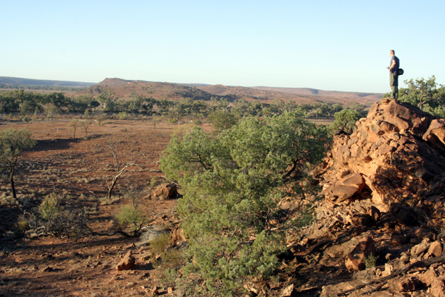
Before breakfast James, Megan and I head off for a walk over some nearby ridges.
Spot several wedgetailed eagles and lots of ‘roos in the sunrise light. Arrive
back in time for a good feed. Some nearby campers tell us that we’ve missed the
twice-weekly tour with a guide, but they had been on one and were very
disappointed as their guide didn’t seem to know much about anything and left
them and all the rest of the group who were on the tour - who’d driven all the
way up from Broken Hill - feeling dissatisfied. They advise we simply drive up
towards Mutawintji Gorge, at the end of the first side road into the park and
follow the trail into the gorge. We give it a shot and find it an easy one-hour
walk in, with lots of roos and even more goats. Along the way we find aboriginal
paintings in a rock shelter near the start of the gorge. The gorge ends in a
large rock pool with a (dry) waterfall at the back. It would be very impressive
after heavy rain. We walk back to the cars and head off towards the intersection
with the Silver City Highway 69km away. We arrive to find asphalt, and as our
course is now to the north to Tibooburra we raise tyre pressures a few pounds,
from 26. I put mine up to 29, but Phil goes to 32 pounds. This so called highway
turns into a terrible road, with sections of asphalt interspersed with longer
sections of very rough dirt. I’m not surprised when Phil calls back on the radio
right on sunset to say he’s blown a tyre 30 km short of Tibooburra. We had been
planning on getting into town before dark, but this kills that as he’s
completely destroyed this rubber and it takes a while to swap it over in the
failing late evening light. We arrive in darkness at 7.30pm and get three
adjoining powered sites at the Granites caravan park in town. After setting up
camp we walk up the main street to the pub where we enjoy a good counter meal
washed down with cold beer. This is living. Walk back to camp and everyone too
tired to do more than fall into bed.
Day 5 – Tuesday,
May 13
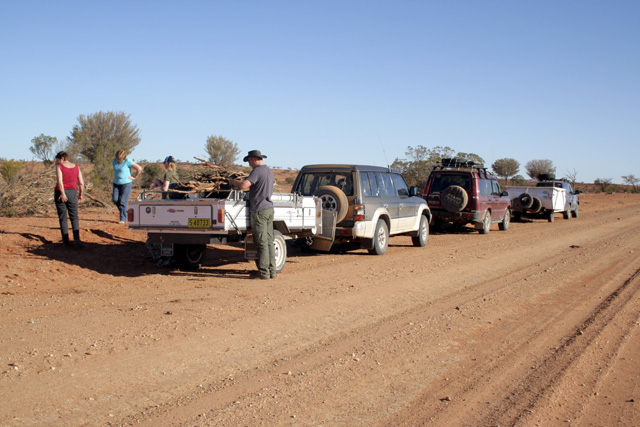
After refuelling we decide to do a day’s driving around the Waratta gold fields.
We attempt to get permission from Gum Vale Station, on whose property the old
field now lies, but can get no answer on any phone, but we leave a message as to
our intent, and our contact details, and so figure since we’re not planning to
go anywhere near the station homestead we should be okay. We head out on the
Cameron Corner road and turn off at the Gum Vale turn-off 13km out. We drive
through Gum Vale Gorge but miss our turn-off and follow the track out of the
gorge and eventually find ourselves heading towards the Gum Vale homestead. We
try a side road (signposted to Mt Sturt) but the land doesn’t “look right”. We
backtrack into the gorge and find an indistinct track heading along the creek
bed, and follow it and soon find ourselves driving through old mine shafts and
remains of mining activity. We stop for lunch under the shelter of gums in the
sandy creek bed, and find more old mine shafts nearby. Care must be taken as
these are not marked or fenced off and if you drop a stone down it’s a long way
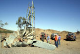
to the bottom. We then continue along the track nearby to the old Waratta mine
area, where there’s a smashed crushing battery and concrete water tank, with a
collapsed windmill. After taking a leisurely look around we try to follow the
track back to the creek but find it blocked, so backtrack to near our lunch site
at the old mill and follow another track up through a gate then down into the
creek bed. From there the track follows the creek, and unlike most other creek
trips this one is smooth and pleasant over sand, winding through beautiful
silver and red River Red Gums, passing the occasional crowd of emus. A charming
drive that is full of pleasant surprises. Eventually we come to the old Waratta
Bore (windmill) off to the right. We check this out, then follow a track back
across the creek and along an old fence line and eventually find ourselves back
on the much hated Silver City Highway. We turn right (south) and drive down to
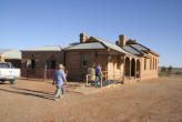
Milparinka and walk around the now virtually deserted remains of what looks as
though it would once have been a thriving town. Surprisingly there’s a serious
bit of building work going on in the middle (?!) of town. After checking
everything else we wander into the pub for a beer only to find it deserted and a
raging fire burning in a small oven, even though it’s 28 degrees outside. After
about 15 minutes the bar tender ambles in, having been somewhere to get change.
We order and consume our beers and then depart for Tibooburra, in time to catch
the sunset from the granite boulders behind the camp ground.
Day 6 – Wednesday,
May 14
We
start this day with a tour of the School of the Air in town, but find that the
very welcoming and informative Tibooburra school has only two students now
accessing its audio-visual computer resources (no longer using the old pedal
radios) and only a handful of day students, so there are concerns that it may be
closed. We then take a drive around town, and to the park to see the whale boat,
a surprising site so far from large bodies of water. Such a boat was hauled here
by Sturt in 1844-45 in search of the “inland sea”. We then head out on the Mt
Wood Road and turn off onto the Gorge Loop Road, taking in the museum of farm
appliances, the old shearing shed and shearers’ quarters and walk around the
outside of the station house at Mt Wood. We follow the Gorge Loop Road, but
frankly find it not much more than a rough road over the plains and the “gorge”
is not much more than a dent in the surrounding countryside, but I suppose if
you lived out here it would seem worth noting. We head back into Tibooburra to
pick up the campers, which we’d left at the campground, and top up the fuel and
then back up the highway to almost opposite the exit point of the Gorge Loop
Road to turn off onto the Jump Up Loop Road. Here we strike the only rain of
the trip, a series of brief showers that turn the top of the dirt roads into a
sticky paste and leave the trailers spattered with red. As we ascend the face of
the jump-ups (they call them mesas in Hollywood) the sun comes out and we take
in a glorious panorama across the plains. We drive on to Olive Downs Station,
then head 4km back along the road and set up camp at the Olive Downs Camping
area. There’s barbecues, long drop toilets and pump water. We get a few rain
showers while sitting around enjoying wine and cheese after dinner, so retreat
into the back of the Aussie Swag to cosily continue the party.
Day 7 – Thursday,
May 15
Depart Olive Downs and head out along the excellent Middle Road, which skirts
along the border and the Dog Fence. Eventually it meets up with the main Cameron
Corner Road just out of Fort Grey and we continue along to Cameron Corner. We
enjoy the standard beer and have lunch at the store, take the usual photos at
the border post and then continue west along the road into South Australia, but
turn off at Bollards Lagoon Station 14km from the corner. Here we head into the
station, a sprawling mass of buildings just off the main road. We knock on the
door and a woman takes $10 for each car and gives us a mud map of the station
property up to the boundary with the Innamincka Regional Reserve. The clay pan
just behind the station house is impressive but eventually we find ourselves
weaving through and over long parallel rows of sand dunes. These disturb us as
we have no sand flags, and are concerned in case of any oncoming vehicles, so
stop to attach a white plastic bag to the aerial on Phil’s Nissan. We pass
numerous side roads, which lead to oil and gas wells, and all of which are
marked as off limits. The Bore Track, as this is called, is a great drive that
weaves its way north parallel with the Queensland border. The northern section
of the track is apparently subject to becoming pretty bad in rain, but we had
nothing but sunshine so continued all the way up to the Nappa Merrie Road
(Adventure Way), just out of Innamincka. This section of the Track rises up out
of the sand dunes onto a gibber plain, and on the northern edge before it drops
back down into the dunes again there’s a great view out to the Merninie System
(in the distance) and the Cooper Creek system, with jump-ups scattered along the
skyline. At Adventure Way we turn left (west) and head into Innamincka, where we
refuel and decide to camp on the town common ($5 per night compared to $15 per
night plus an extra charge for something at Cullyamurra Waterhole) just 500m
down the hill from the CBD, which consists of a pub, a general store, a
shower/toiler block and the restored Australian Inland Mission building. We set
up camp among clumps of bushes near Strzelecki Creek, which is just muddy, but
the Cooper Creek, another 200m further over has plenty of water. There are
occasional long drop toilets, and a shower block opposite the pub ($4 for 4
minutes of hot water – and make sure you have plenty of coins because the pub
doesn’t). However, the pub does have good food and most other wants can be
provided at the store.
Day 8 – Friday, May
16
We
drive out to Cullyamurra Waterhole, 15km out of town, back along Adventure Way.
We start at Burke’s Grave, and are just stunned to find this astonishingly lush
waterhole (actually a section of Cooper Creek that’s 21km long, 150 metres wide
and, at the Eastern (inlet) end 30m deep. There’s bird life everywhere, and lots
of huge gum trees and even grass along the banks, but walk 20m away and you’re
back in sand and another 20m and you’re among scraggy dead looking trees. We
find other camper trailer folk camped along here. The camp ground is about 8km
long, with occasional long drop toilets, the odd barbecue and plenty of shelter.
We wish we’d opted to spend the extra and camp here, but we just didn’t know. We
drive to the end of the track, at the end of the campground, and decide on the
walk to the Choke, as the narrow rocky inlet is called. The walk is fairly easy,
the views wonderful over the waterhole, and there’s heaps of bird life and
plenty of turtles visible in the water. How Burke died here has me beaten. Near
the Choke, on the right amongst red boulders, we find lots of chipped aboriginal
carvings. It’s after 1pm by the time we get back to the camp ground, so we stop
to have lunch on the bank of the waterhole, under the shade. We head back out
onto the Adventure Way and turn east (left) and around to near Nappa Merrie
Station and then in to the Dig Tree. It’s an $11 per vehicle hit to drive in, as
this is on private land, and all the facilities are provided from these funds.
It’s such an iconic spot that we grudgingly pay up and take all the obligatory
photos before heading off, as it’s after 4pm and we have an 80km drive back to
Innamincka. However, instead of turning back west, we continue north-east for
15km and turn onto the Flood Bypass Road. This is right on sunset, and the
golden light on the jump-ups and the distant hills are glorious, but the track
is narrow and in places badly eroded, so care is needed, but it was worth the
effort and we get back just on dark.
Day 9 – Saturday,
May 17
After dropping the garbage off at the Innamincka tip – worth the trip across the
gibbers to see the turnout of crows – we head off for the Coongie Lakes (a
desert parks pass needed, bought at the general store), 120km north. The track
crosses some imposing sandhills (all generally clay topped so there’s no tough
going) and winds through dry sandy desert country. Two thirds of the way there
you come to the Kudriemitchie Outstation, a relocated building from the old
Innamincka station, that’s being prepared as a ranger and scientific study base.
Aside from the large waterhole behind the outstation this is dry and harsh
country, so after a while, while driving along the back of a long orange
sandhill it’s surprising to see the odd muddy hole on the left. Then suddenly
you see before you a small sign to the right, indicating Coongie Lake this way.
You drive up over the top of the dune, and there before you is a sheet of water
that just leaves you slack jawed. There are black swans and bird life
everywhere, and lots of bird life. It’s just astonishing to find this sheet of
green and beautiful water in the midst of such desolation. We have lunch on the
banks of the lake under the shade of pleasant gums, then take the long drive
back into Innamincka in time to take the girls out for a meal at the pub and a
break from cooking. The 500m walk up from the Common is pleasant under the stars
anyway.
Day 10 – Sunday,
May 18
Today we leave Innamincka behind after refuelling – with diesel at $2.01.9 per
litre! We head off south along the Old Strzelecki Track. We avoided the newer
track, as it’s become a vast dirt highway and relatively boring. The Old
Strzelecki is a little less civilised but is not the straggling bush track we
were lead to believe. The most interesting aspect is the oil wells you come
across right on the edge of the track, rocking away, pumping oil from the
ground. At Merty Merty you have a choice, to turn left back towards Cameron
Corner, or right, over the sandhills towards the new Strzelecki Track, which we
take. After a couple of hours we arrive at Montecolina Bore. This lies behind
sandhills to the west of the track, but is well signposted. If you’re going past
this is a must stop as it is a remarkable oasis in a sea of sand. A constantly
running bore feeds a permanent pool of water, around which are found vast flocks
of white parrots (short beaked galahs), as well as a healthy population of
magpies which have become so used to people’s presence that they will feed from
your hands. The flies notwithstanding we enjoy our lunch before heading on
towards Mt Hopeless, just north of which we turned off to the left and wind our
way towards the Gammon Ranges. At Moolawatana homestead we stop and decide to
check access to Terrapina Springs, our planned stop for the evening. The
property holder – Mike – is at first very opposed to our stopping there as he
has had considerable trouble with people with guns who had apparently cut down
his population of yellow footed rock wallabies. However, our appearance, and our
assurances of our good intentions leave him convinced that we are considerate
campers, and with strict warnings to camp no closer than 500m away from the
waterhole we head out along a goat track of a public road towards the Springs,
to the west of the homestead. These are a pool on the left of the track, where
Hamilton Creek crosses the road. We camp 300m up the creek bed on the right and
James and Megan head off to spot the wallabies, since both work with native
animals. The rest of us take in the glorious sunset then settle down around a
good campfire with a few wines.
Day 11 – Monday,
May 19
We
decide to check out the next springs down the creek, accessed by a side track
about 8km down the track which crosses the creek, but after a lengthy crawl
along through hills we came to the conclusion that these springs are closed to
the public, and as they are on an adjoining property and we have no approval to
go any further we turn around and return back to the main track past Moolawatana
down to Balcanoona, where we are to turn off towards Arkaroola. The drive is
scenic, skirting along the eastern side of the Gammon Ranges and we arrive at
the Arkaroola turn-off with no trouble, to turn off towards Arkaroola. However,
we plan to camp at Weetootla Gorge, which is about 4km off the road up to
Arkaroola and well signposted. There is a good long drop toilet but we move 500m
further up the gorge as there are already several campers set up in the area. We
set up camp on a flat area at the end of the road, and then head straight off
into Arkaroola, where we plan showers and a look around before doing the
astronomy trip at one of the resort’s observatories. We have just arrived when
we run into Doug Sprigg, the resort operator, who is having trouble with his
generator, so Phil, an old hand with electronics, sets off to give him some
assistance. The lights are restored after the rest of us finish our showers in
the dark but we are at least able to refuel and then enjoy a restaurant meal
before the trip up a goat track of a road to the nearby hilltop observatory in
an old Toyota bus. The observatory is interesting, and then we drive back to
Weetootla for the night, arriving about 10 minutes apart allowing the dust to
settle after each car’s passing.
Day 12 – Tuesday,
May 20
After breakfast the rest of us set off to follow James and Meagan up a walking
trail at the head of the gorge. The first bit is dry and not particularly
interesting, but eventually we begin to find pools of water, then running water,
all of which is being fed from a spring upstream. James and Meagan had found
another population of Yellow Footed Rock Wallabies there and spent some time
photographing them. After returning to camp we have lunch and then pack and head
off west 100 km to Leigh Creek, where we refuel and restock with food then head
south to Beltana, where we turned off towards Warraweena Station. This is an old
sheep station of 355 sq km which has been turned over to eco-tourism, including
four wheel driving. We know the manager, Stony Steiner, a jovial Swiss who has
lifted the battered property to a well run and popular spot for campers, 4WDers,
mountain bikers, hikers and anyone else looking for a breath of fresh air in the
Northern Flinders Ranges. We set up camp at our designated area, with nobody
else around, and are joined for dinner by Stony. Lots of wines later around a
camp fire before we all retire for a good night’s sleep.
Day 13 – Wednesday,
May 21
After showers and breakfast we take Stony’s recommendation and set off on the
toughest 4WD trek the park has to offer. This starts with a full verbal
explanation by Stony, a set of trip notes and maps. The track winds its way up a
steep and narrow creek bed that at times requires someone outside with a two-way
giving instructions to each driver. After lunch next to an old copper mine we
eventually find ourselves on top of a mountain with panoramic views over the
Northern Flinders. There is an easy way down, but we decide to be brave and take
the tough trip, down the appropriately named Suicide Hill. This is a two-in-one
descent down a shale hill, and introduces James to some of the abilities of his
4WD. We then get bushed and find ourselves heading up a dead end gorge before
working out where we are and head back, finding our way back to camp and having
a leisurely late afternoon around camp.
Day 14 – Thursday,
May 22
After showers we head back to Beltana to take a look around. This was once a
thriving town, which built itself on the Overland Telegraph Line, the Gahn
Railway and then large copper mines in the area. But all this ran out and the
once prosperous town died, leaving a smattering of beautiful old stone houses
scattered amongst old chimneys and the skeletons of once thriving homes. The
town is now largely saltbush with these scattered beautiful old buildings, all
now privately owned – even the police station and railway station. We spend a
heart rending hour in the town cemetery, checking out the graves, some of which
are still lovingly cared for and others sadly falling into decay. You had to be
there to experience it. After Beltana we drop off at the Sliding Rock copper
mine ruins on the way back to Warraweena, which was a small town on its own,
with its own pub and shops, until the minerals ran out. We head back to camp to
ready ourselves for the long trip back to Sydney, as tomorrow we leave for home.
Day 15 – Friday,
May 23
After a frustrating wasted hour fixing a puncture I discover on arising, we say
our sad farewells to our friends and Stony and head back towards Sydney, vie
refuelling at Beltana Roadhouse, heading into Wilpena Pound through Brachina
Gorge, taking in some spectacular scenery on the way towards Wilpena Chalet, but
before we got there we turn off south east towards Yunta. The first part of the
trip is pretty good and very scenic but the last half is over a flat and largely
uninteresting landscape, but the South Australian dirt roads, as almost always,
are great. I think the NSW Government could learn a lot from the SA roads people
about how to make a dirt road. Just out of Yunta we run into a gypsy caravan
being pulled by four camels, with another half dozen tethered to the back. I
can’t believe such a thing in this day and age. At Yunta we refuel and turn east
towards Broken Hill. A long day’s drive of 601 km gets us into The Hill at 8pm.
Our plans to grab a couple of cabins to break the run of nights in the camper
and, for poor James and Megan, in their little tent, is destroyed when we find
that there isn’t one single room available in town. So once again we set up camp
in a caravan park, then drive back into town to have dinner at a restaurant.
We’re feeling tired and out of sorts after a long day on the road and just want
to hit the bed and get some sleep.
Day 16 – Saturday,
May 24
After breakfast at the Barrier Social Democratic Club – recommended – we hit the
road for the long drive back to Forbes, all 793km of it. We get in around
7.30pm, thoroughly tired, and hit the hay early.
Day 17 – Sunday,
May 25
The
drive home over the mountains is uneventful, except for the traffic jam at the
roadworks which delayed us by an hour. The contrast with the complete absence of
another living thing on the Bore Track couldn’t be starker. Arrive home at 7pm
wishing we were still back out there, with the endless stars overhead, big white
gums all around and the promise of another day’s exploration of this great
country, but knowing that only work and the computer screen await. Ah, such is
life!
Costing
Total distance covered:
5430 km
Total fuel bill:
$1433.38 (ouch!)
|
|
 |
 |
 |
|
Lunch on the banks
of the Bogan River at Nyngan. |
Don’t
like the taste of that paddymelon. |
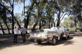
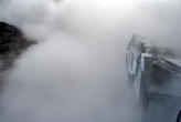
The final run into
White Cliffs in the sunset was spectacular. |
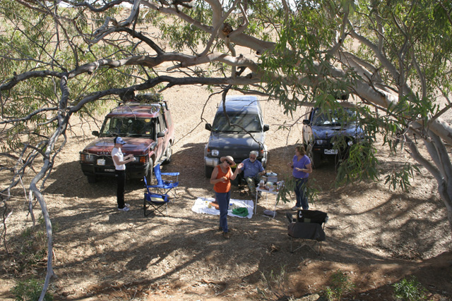
Our first camp, at
White Cliffs. |
|
|
 |
 |
 |
|
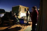
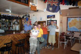
We settle in for an
evening of good eating and drinking at White Cliffs. |
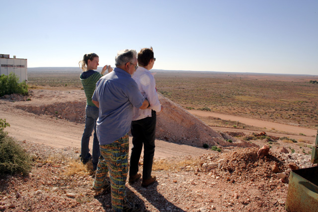
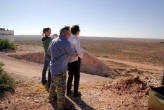
Megan, Phil and Jan
looking out over the plan at the back of White Cliffs. |
Megan, James and Jan
enjoying the tour with crazy Jock. |
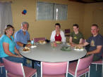
Mother’s day lunch
at the White Cliffs Sport Club. |
|
|
 |
 |
 |
|
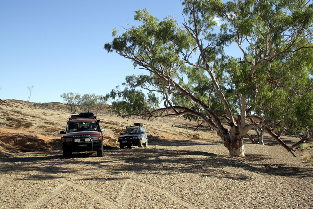
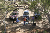
Collecting firewood
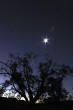
before entering Mutwintji National Park. |
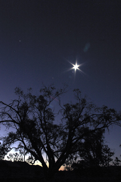
Moon rise, Mutwintji
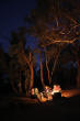
National Park. |
Nothing beats the
please of a good camp fire in the bush, Mutwintji National Park. |
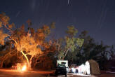
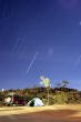
Star trails,
Mutwintji National Park. |
|
|
 |
 |
 |
|
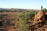
James on
top of the world – well, at least a ridge – sunrise, Mutwintji
National Park. |
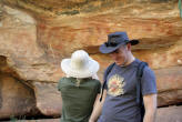
Megan and James with aboriginal artwork,
Mutwintji Gorge. |
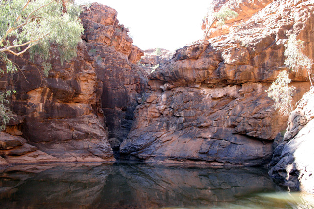
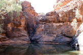
Rock pool at the head of Mutwintji Gorge. |
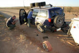
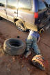
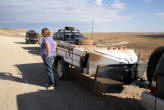
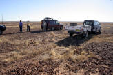
Phil’s busted tyre,
sunset, 30 km short of Tibooburra. |
|
|
 |
 |
 |
|
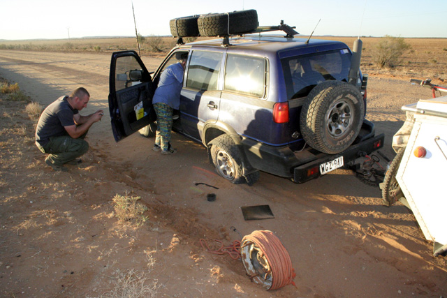
Phil burrows in to
get the jack under his car, Silver City Highway.
|
Driving through the
beginning of the Waratta Goldfields. |
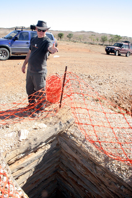
James
checks the depth of an old gold mine Waratta Goldfield. Most mines
don’t have any warning fence around them. |
At the old mill,
Waratta Goldfield. |
|
|
 |
 |
 |
|
Enjoying
lunch under the trees, Waratta Goldfield. |
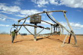
The old bore at the
Waratta Goldfield. |
Driving
down the creek bed, Waratta Goldfield. |
The old court house,
Milparinka. |
|
|
 |
 |
 |
|
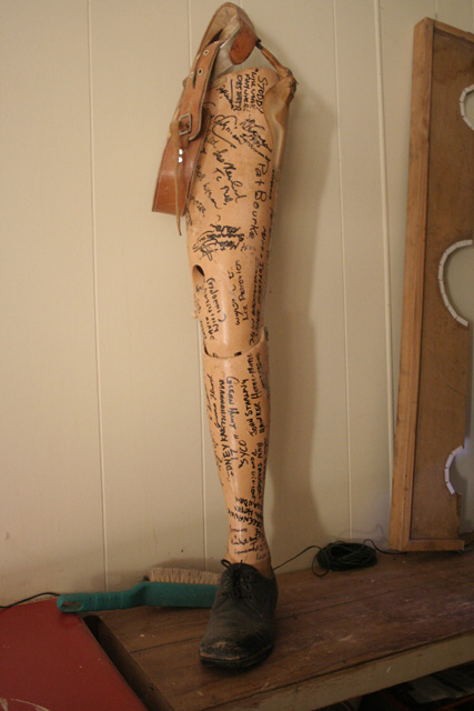
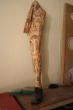
One of the curios
behind the bar at the Milparinka pub. |
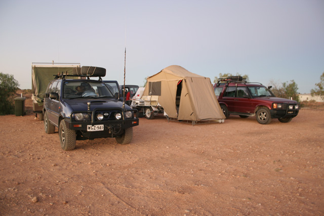
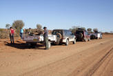
Our camp set up at
the Granites camp ground, Tibooburra. |
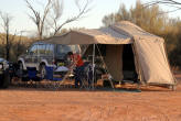
James and Megan’s
humble set-up at Tibooburra. |
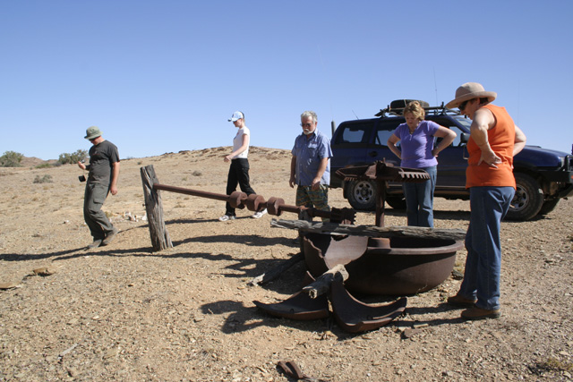
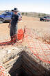
James
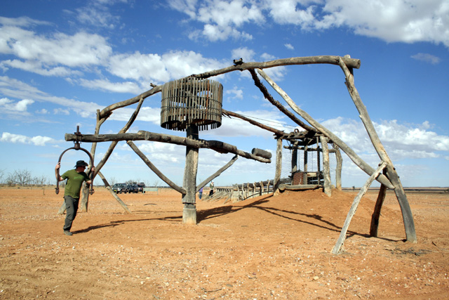
tests the whim at Mt Wood Station. It works. |
|
|
 |
|
All muddied up at
the top of the jump-ups on the way to Mt Olive Station. |
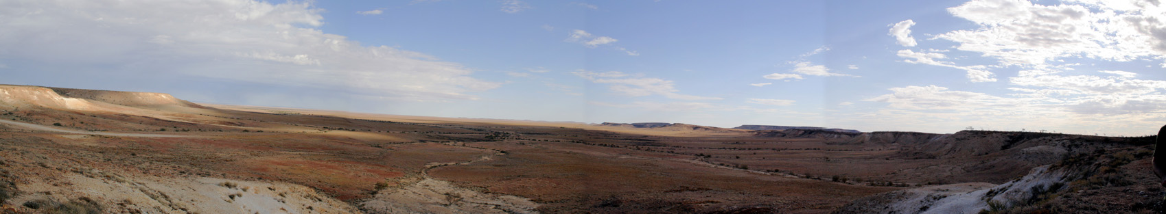
The view from the
jump-ups. |
|
|
 |
 |
 |
|
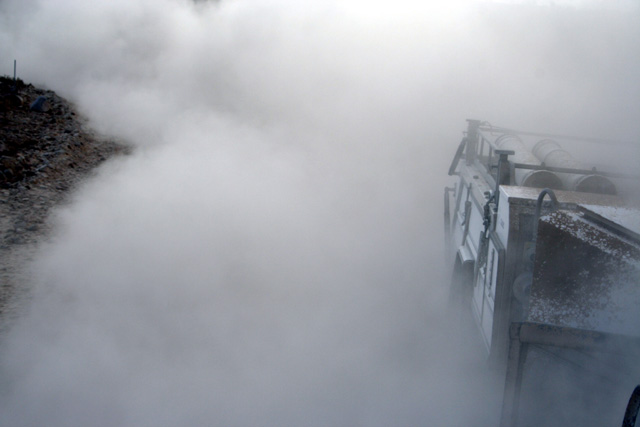
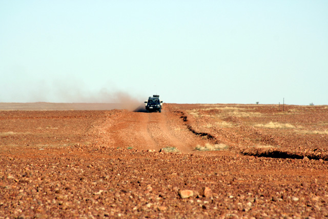
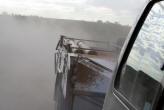
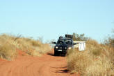
The sort of dust you
get in the bush . . |
. . . until you get
to bulldust.
|
Our
Aussie Swag set up at Mt Olive camp ground. |
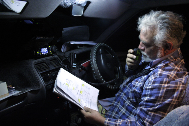
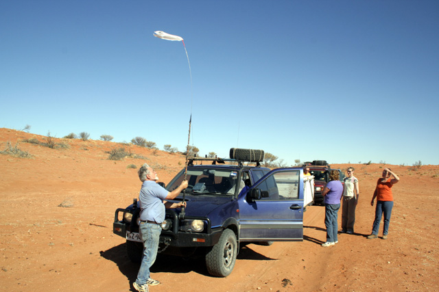
Phil was
on duty with his massed radio communication systems. |
|
|
 |
 |
|
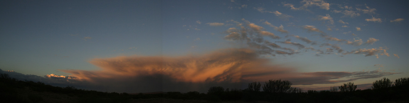
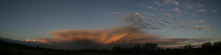
This
storm passed us to the north at Mt Olive camp ground. |
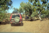
Our Pajero and AS
along the dog fence, Middle Road, on the way to Cameron Corner. |
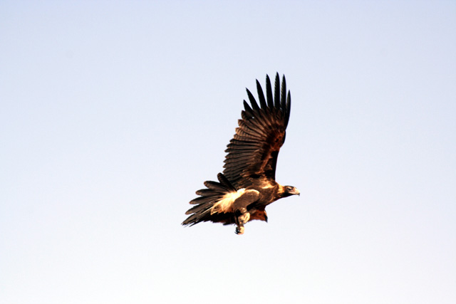
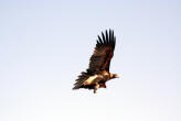
Wedgetailed eagle,
Middle Road. |
|
|
 |
 |
 |
|
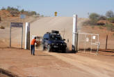
Jan welcomes Phil
and Lyn to the border, Cameron Corner. |
A cool beer in the
Corner Store, Cameron Corner. |
Crossing the clay
pan behind Bollards Lagoon Station, at the beginning of the Bore
Track. |
Fitting our home
made sand flag, Bore Track. |
|
|
 |
 |
 |
|
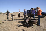
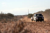
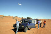
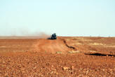
Phil and Lyn, Bore
Track. |
Phil on the gibber
plain, Bore Track. |
At the lookout, Bore
Track. |
James and Megan,
Bore Track. |
|