Mungo-Menindee-Willandra
24 September to 6 October 2005
by ken mcguiness
Since
our last outback trip, we’ve been looking for an opportunity to head out west
again. Our earlier plans to visit Birdsville or down the Darling River haven’t
yet come to fruition but when the Australian
CamperTrailers Group scheduled a meet at the beginning of the school
holidays we took the opportunity to make it the start of a two week tour taking
in some highlights of western NSW, including part of the aborted Darling River
trip.
Saturday 24 September – Tuesday 27 September
By the time we got to Shallow
Crossing for the CamperTrailers Group meet, most of the participants were
already well settled. It was a great occasion with 40 campers and more than 100
people attending – the Group’s website has a report
and pictures from the gathering.
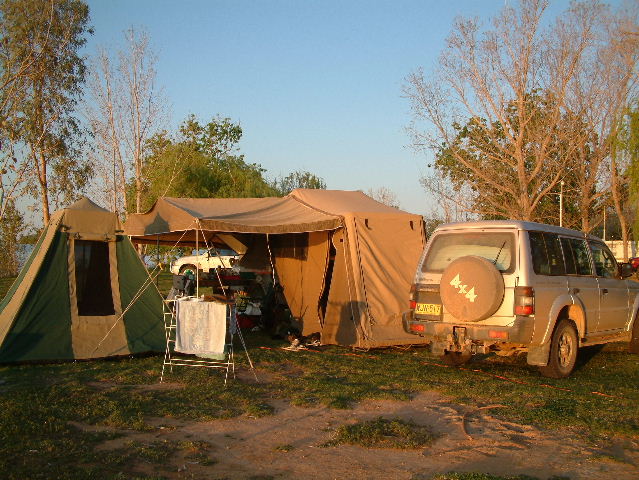
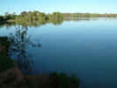
Shallow Crossing is a privately owned camping area on the banks of the Clyde
River north west of Batemans Bay. We found a spot with a view of the river and
set up our camper for the first time (having sold our old camper to buy a 2 year
old Kimberley
Kamper). We had a very pleasant few days here although the weather was not
the best with intermittent rain for most of the time. On the Sunday, we took a
drive to explore a disused goldmine surrounded by rusting relics of the
endeavours of the early settlers in the area. For the rest of the time, we
relaxed around camp catching up with other members of the group, the kids played
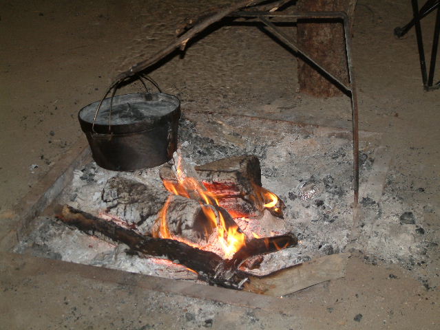
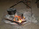
in the river and built campfires and Renee tried her hand at camp oven cooking
with mixed results: the herb damper was delicious, roast dinner great, dumplings
so-so and the less said about the scones,
the better!
Tuesday 27 September
Our plan to get to Hay today fell by the wayside after a late departure from
Shallow Crossing. We enjoyed a scenic drive along the lower reaches of the Clyde
River before turning west through picturesque state forest. After meeting Kings
Highway, we had a steep climb up the mountain to Braidwood then continued on
through Queanbeyan (lunch stop) and circled Capitol Hill in Canberra. We reached
Wagga Wagga around 4pm and decided to overnight here rather than push on to
Narrandera or Hay. There was also some concern whether we’d be able to get
into Mungo National Park because of rain in the area (roads in Mungo were now
closed) so we started thinking about an alternative route.
Wednesday 28 September
Today we followed the Sturt Highway due west through Narrandera, Hay (lunch
stop) and onto Balranald. This drive cuts through the flat open plains of the
mid-west and we were surprised to see the countryside quite lush and green, a
real contrast to the endless dry brown we saw on previous journeys through this
area. For much of the afternoon we were driving into a heavy storm and our
chances of getting into Mungo were looking slim. By the time we reached
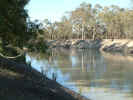
Balranald (the turnoff to head into Mungo) the weather had eased a little and we
took a site in the local caravan park on the banks of the Murrumbidgee River.
Thursday 29 September
Thursday dawned fine and sunny and we packed up and headed for the Visitor
Centre to check on road conditions. The road into Mungo was now open although
the loop road in the NP was still closed. We filled up with petrol and groceries
and headed north out of Balranald on the road toward Ivanhoe. After about 50kms
the route leaves the bitumen and heads west again on dirt tracks through
semi-arid countryside. For the most part, the road had dried out quite quickly
although there were still sections of heavy mud and large puddles which left
their mark on the car and camper. Again, we were surprised by the greenery and
fields of wild flowers interspersed with the red sand and claypans we had
expected to see.
After about 80kms we enter the Willandra Lakes World Heritage Area – a
series of ancient crescent shaped lakes once fed by what is now Willandra Creek
- and turn north on the Arumpo Road. Here the road cuts a red ribbon across the
floor of the now-dry Lake Arumpo, a taste of what we can expect at Mungo NP.
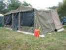
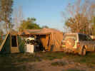
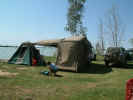
We arrived at Main Camp just inside Mungo National Park for a late lunch. The
campground was not crowded since many had left before the storm passed through
on the previous day. We took our time to find a site that was dry and looked
like it wouldn’t suffer too much if it rained again. We set up camp and added
the screen annex (because of the swarms of flies who seemed intent on sharing
our lunch) and then headed off to the visitor centre.
Displays
in the visitor centre give a good explanation of the ebb and flow of water
through the lakes and how layers in the dunes have captured a picture of
geographic and human development in the area. We were surprised to find that it
was here that someone discovered (or proved) that the earth’s magnetic field
changes over time. Artifacts collected from the area show that around 30,000
years ago magnetic north was at about 120 degrees to it’s current position!
Although the loop road (which provides a 70km tour of Mungo Lake and surrounds)
was still closed, the first section to the Walls of China was now open and, with
sunset approaching, we took the opportunity to drive down and explore. The dirt
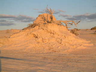
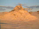
road cuts across the floor of Lake Mungo to its western edge where a high
crescent shaped dune (lunette) curves around from north west to south east.
The western face is layers of clay and hard packed sand which have been
eroded by wind and rain to form striking pinnacles with clearly defined layers
showing the history of the area over the last 50,000 years.
On the eastern face, loose white sand spills down to meet the grass and scrub
on the outside plain. Apparently, prevailing westerly winds are pushing the dune
east at about 3m per year!
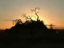
We were very lucky to be here as the sun set with ample time to walk around
the dunes as the changing light painted the landscape in stunning colours,
highlighting the telltale layers in the sand. As dusk closed in, we headed back
to the visitor centre (for a shower) and then back to camp for dinner.
Friday 30 September
Another clear sunny day and our hopes that the loop road around Mungo would be
open were satisfied. We have the information sheet from the visitor centre which
provides information for the self guided tour and head out toward the Walls of
China then turn right onto the loop road which stretches off in the distance
roughly parallel to the white sand of the dune. A little way along a sidetrack
accesses a picnic area that offers another view of the eroded Walls. Further
along we come to the first of many “tanks” – a rough dam dug in the dry
lake floor to provide water for stock that used to graze the area. For the most
part, these tanks are now dry with perhaps a foot or two of stagnant water in
the bottom from recent rain.
Near here, a section of the dune remains in its original form – covered
with grasses and low scrub. We were surprised to learn that the Walls of China
and the history that’s been uncovered have emerged only in the last 100 years
or so as grazing of stock brought by European settlers removed the ground cover
and exposed the land to erosion by wind and rain. The evidence of the soil being
eroded and washed down to the lake bed is apparent; the westerly winds then blow
the sand back up and over the dune to the lee side.
Soon, the track climbs up to cross the dune at its southern end. Here, you
can again walk amongst the eroded dune – it’s quite amazing, in the space of
just a few metres, to walk down through 30,000 years of the earth’s history.
Crossing the dune, the road descends down onto “Allan’s Plain” – mostly
grasses and mixed belah and mallee woodland. Along this road is Allan’s Tank,
a large dam and what’s left of one of the corrugated iron sheds used as an
outstation by station hands since the late 1800’s. Further along the road
Mallee Stop offers a nature walk through Mallee woodland giving a good
opportunity to see the natural flora of this area.
Belah Camp is the second camping area in the NP and is located at about the
half way point on the loop drive. We stopped here for lunch in the shade of the
trees before continuing on the drive. The next stop was at yet another large
tank – “Round Tank” has some water and is used as a trap to catch feral
goats that frequent the area.
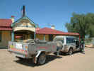
Continuing around the back of the dune, a side track took us right to the
foot of the white sand dune to Vigars Well once used as a staging post by Cobb
and Co coaches. The steep climb to the top of the dune is well worthwhile,
offering a spectacular 360 degree view of the lake floor and the surrounding
plains. It’s easy to see here how the sand spilling down the eastern face is
slowly consuming the grassy plain. The kids had a great time here playing on the
slopes.
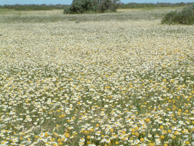
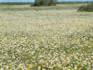
Back on the main road, we drive past grassy paddocks covered in spring
wildflowers almost as far as the horizon, re-cross the dune and lake floor at
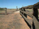
the western end before reaching the ruins of Zanci Homestead.
The ruins consist of the dugout pantry/ cellar, chimney and hearth of the
homestead, windmill, outhouse and woolshed. It was fascinating to wander around
the remains and picture the hardships the early settlers must have endured to
carve out an existence in this harsh environment.
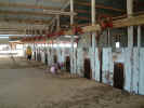
From here, the road again descends onto the lake floor and rejoins the road
back to the visitor centre and the massive Mungo Woolshed. The woolshed has some
excellent interpretive signs to help you get a feel for life as it was back
then.
Whilst the 70km loop road could be driven in a couple of hours, it really
deserves the whole day to appreciate all that the drive has to offer –
spectacular scenery and fascinating insights into development of the landscape
and the record of indigenous and European life over 40-50,000 years – just
amazing!
Just outside the National Park, we visited Mungo Lodge for an ice cream and
then took a drive down the road to collect some firewood before returning to
camp in time for sunset, dinner and a camp oven tea cake - yum.
Saturday 1 October
Although we could have easily spent another day at Mungo, we packed up and
headed west again to join the Darling River. We got our first glimpse of this
iconic outback lifeline at the town of Pooncarrie, roughly half way between
Mildura and Menindee. We hadn’t really known what to expect but there was
water in the river although it was well below the top of the bank.
As it happened, it was race day in Pooncarrie and the town was being
inundated by visitors from near and far for the afternoon’s festivities. The
local campground, in amongst the trees along the river, was quite crowded. We
stopped for lunch in the park and then watched the first race from outside the
track before heading up the Darling toward Menindee. The red ribbon of the road
follows the river quite closely for most of the way although it is mostly out of
sight behind the line of large trees that cling to its banks.
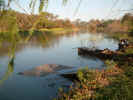
We arrived in Menindee mid afternoon to find the visitor centre and nearly
everything else shut (was everyone at the races?). In search of a place to camp,
we first headed out to Kinchega National Park. River Drive snakes along the
western bank of the Darling below Menindee Lake and offers numerous lovely
campsites amongst the trees. Unfortunately, the toilets are few and far between
and this prompted us to check out the local caravan parks – just as well,
since we were almost out of fresh water in the camper.
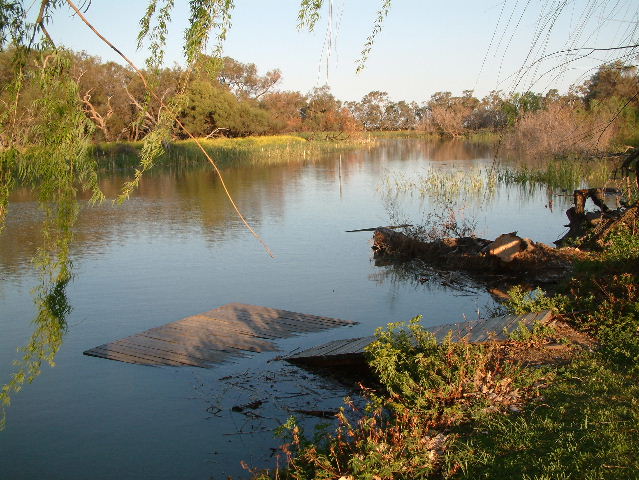
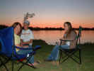
Lake Menindee caravan park was depressingly dry and dusty perched on the
“shore” of a very dry lake. We almost headed straight back to the river but
instead drove further out to Copi Hollow, part of the man made Menindee Lakes
water storage system and home of the local boat association that runs the
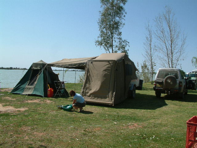
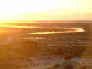
caravan park. This was like an oasis – we had a perfect grassy campsite right
at the water’s edge and with a perfect view of the sun setting over the lake.
Sunday 2 October
Another beautiful day for us to explore the area. Menindee lakes consists of
a number of natural and man made lakes fed by the Darling River. A system of
weirs was built in the early 1960’s to trap the flow down the Darling to
provide water primarily for Broken Hill and the surrounding areas. Apparently,
estimates of the flow of water were more than optimistic (or the water has been
diverted for irrigation up stream) and there is not enough water to fill all of
the storage created by the project. Consequently, flow into the two lower (and
larger) lakes – Cawndilla and Menindee – has been shut off for sometime.
These lakes would more than double the storage capacity of the system but
apparently, seepage through the soil is such that it requires 2.5 times the
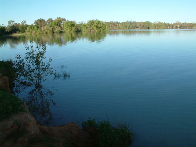
actual volume of water to keep them full. In contrast, the upper lakes, Copi
Hollow and Parmaroo, have plenty of water, are home to a variety of bird life
and are popular boating, fishing water skiing spots.
We spent the morning exploring the southern shore of these lakes with rows of
dead trees standing somewhat forlornly just off shore. There are numerous free
campsites along this stretch although they probably suffer from dust from
traffic on the road. We visited the campsite of the 1860 Burke and Wills
expedition and the system of weirs built to control the flow of the Darling
(more camping areas around here) and meandered along a series of rough sandy
tracks by the river before heading back to Copi Hollow for lunch.
After lunch, we headed back out for more sightseeing. Sunset Strip is a small
community of perhaps 100-150 houses built on the shore of Lake Menindee. When
there was water in the lake, it would have been a boating mecca. Sadly, it now
looks out over a large dry grassy plain punctuated by dead trees standing in the
sand around the shore line. The concrete boat ramp leads nowhere and jetties and
pontoons lie stranded.
We then headed out to Kinchega National Park. The Lake Drive skirts around
the opposite shore of Lake Menindee, down past the equally-dry Cawndilla Lake
and link onto Emu Lake Drive (also parched) before delivering us to the visitor
centre at Kinchega Homestead and Woolshed. Here there are showers, bunk room
accommodation and more interesting displays in the woolshed and surrounding
buildings. We headed back to Copi Hollow to enjoy happy hour while we watched a
spectacular sunset over the water. Then we went back to town for dinner at the
historic Menindee Hotel. The pub retains all the charm of an old outback pub
although the interior has been modernized after fire almost destroyed the
building several years ago.

Monday 3 October
On the way out of Menindee we stopped at the Survey Tree that marks the sport
where the initial survey team camped in December 1882. For about 200 kms the
road to Ivanhoe traverses more of the classic outback countryside – flat red
plains now covered with green grasses and carpets of white, yellow and sometimes
purple wildflowers with occasional stands of larger trees around watercourses.
We had lunch and refueled at Ivanhoe before heading south down the Cobb Highway/
Kidman Way and turning east at Mossgiel toward Hillston.
Our next stop was at Willandra National Park, a 20km detour off the Hillston
road. The National Park is part of the original Willandra Station, one of the
iconic outback stations of the early days of European settlement. It was
immortalised in the anonymous poem, Flash Jack From Gundagai:
I've
shore at Burrabogie and I've shore at Toganmain,
I've
shore at Big Willandra and out on the Coleraine,
But
before the shearing was over I wished I was back again
Shearin'
for old Tom Patterson on the One-Tree Plain.
A lot of work has been done restoring the homestead and surrounding
buildings: shearers quarters, foremans cottages, a thatch-roofed ramshed and
other areas. In fact, the woolshed is still used by surrounding properties in
the peak spring shearing season. It’s interesting to wander through the
restored homestead and imagine the contrast between the life of the station
owners and that of the workers and farm hands. Its easy to sit on the fly
screened verandah and imagine high tea being taken while watching tennis on the
lawn or paddlers from the pontoon on Willandra Creek.
The park offers accommodation in the homestead, cottage and men’s quarters
plus campsites in secluded bush clearings near the creek. We found a great spot
to set up and the kids got a campfire going to get coals for our last camp oven
dessert.
Tuesday 4 October
The next morning we took the 20 km drive around the property using the
information sheet to provide a description of the landscape and points of
interest. Again, we could have spent another day here to better appreciate the
location but instead retraced our tracks to the main road and headed to Parkes
via Lake Cargelligo (lunch stop) and Condoblin.
Wednesday 5 October
Today we visited the Parkes Radio Telescope and were lucky to be on hand to see
it moved into a new position. The visitor centre offers interesting displays and
informative movies.
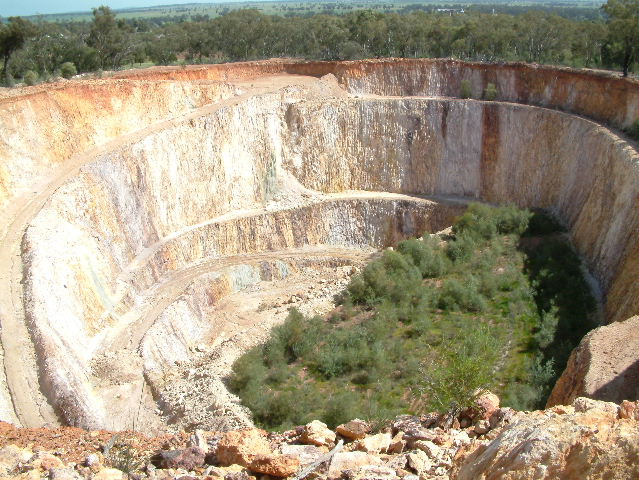
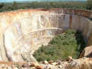
Another 20+kms on we stopped at Peake Hill for lunch and a walking tour of
the open cut goldmine – series of huge excavations which are now mainly
dormant. At the entrance to the mine is the remains of a kitchen hearth that is
all that’s left of earth-floored corrugated iron shack which was home to one
of the mine workers, his wife and children as recently as the early 1960’s.

Thursday 6 October
For the first time since we drove into Mungo National Park, we encountered
some light rain on the trip home to Sydney.
Despite
the inclement weather at the start, we had a great trip reacquainting ourselves
with the flavour of the outback and seeing some fascinating sights. In
particular, Mungo National Park is a truly amazing place and it was great to see
a different side of the outback after recent spring rains brought parts of the
desert to life.


|