Red Centre Trip
Wollongong - Mildura - Port Augusta -
Darwin and back
May to August 2006
part
two
The following day we were off early
to our next destination, Palm Valley.
This trip was not
without incident. I was mapping our trip using a program on the laptop
computer and this was connected to my GPS and a monitor which were both
mounted on the dashboard. On this very bad dirt road, we’d travel for 5
minutes and the computer would crash. So we’d pull over and get out, fiddle
with the computer in the back, get in and start driving again. Five minutes
later, crash goes the computer again. This happened 4 or 5 times and Marge was
beginning to wonder if we would be spending the next few weeks or so
traversing this 100 km stretch. Happily for Marge, but not for me, I gave up
on the computer in disgust. It eventuated that it was a fault in the power
connection to the laptop. (The laptop I was using was a Optima Centoris and I
was later told that the power connection on these computers were known to
fail. I saw an Optima dealer in Katherine later on, but he said it would take
a couple of weeks to fix so I decided to leave it until I got home. I was left
without my computer for the rest of the trip which to put it politely annoyed
me just a tad). I have since replaced the Optima with a Toshiba.
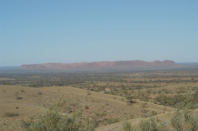
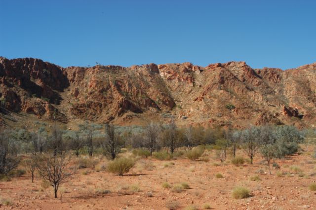
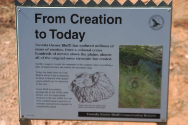
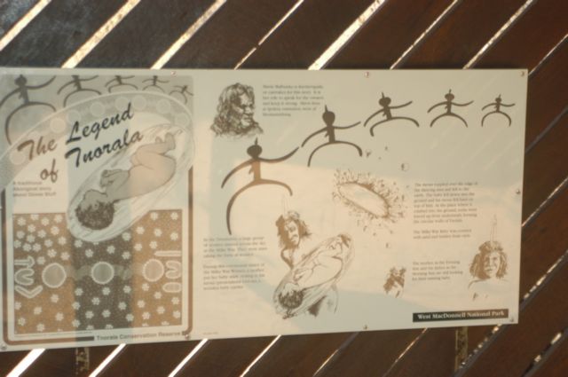
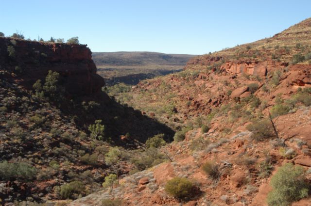
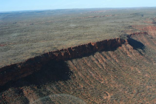
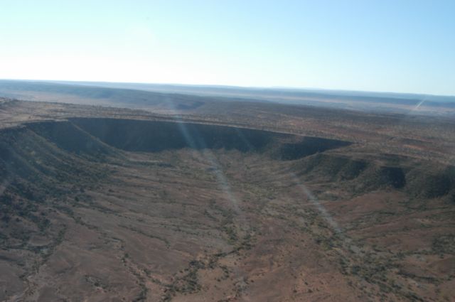
Along the way is a huge meteorite crater
named Gosses Bluff. From the lookout at Tyler’s Pass a few kms before the
bluff, it is almost as impressive as Uluru.
|
|
|
|
|
|
Gosse Bluff from
Tylers Lookout
|
Inside Gosse Bluff
|
Our Story
|
The Aboriginal Story
|
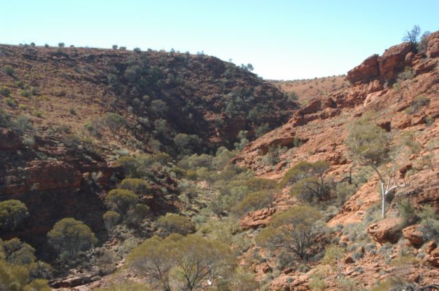
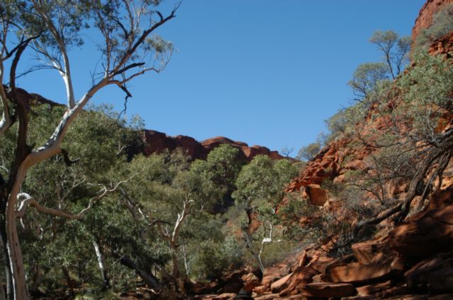
Then it was on to
Palm Valley .
The camping area at Palm Valley is accessed by a longish four-wheel drive
track which is sandy, but not too bad. The camping area is lovely and treed,
with all the necessities of life: solar showers, flush toilets, and some
water. For Greg it had two selling points: there was a fire pit for cooking
and it was inaccessible to anything but 4x4’s which cut out a lot of tourists.
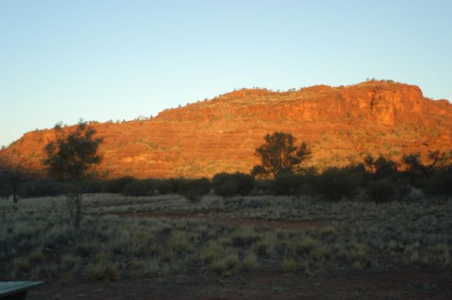
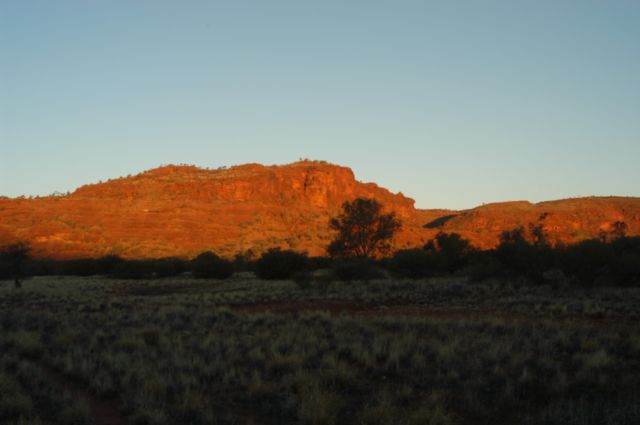
Our camping spot had a lovely view of a cliff that glowed red at sunset. So we
used it as a base and stayed three nights.
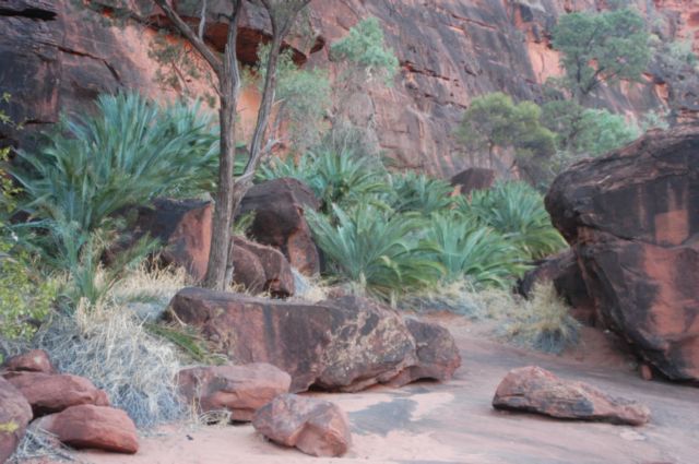
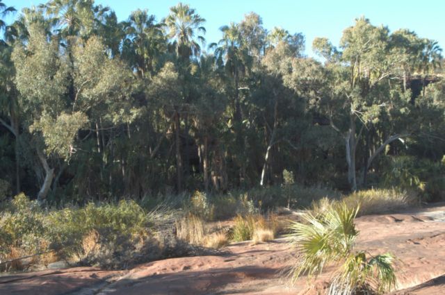
The road to Palm Valley itself was a bit more challenging. We had to drive
along a rock streambed, picking our path carefully as there was no road. It
was worth it as Cycad Valley and Palm Valley offered some lovely walks.
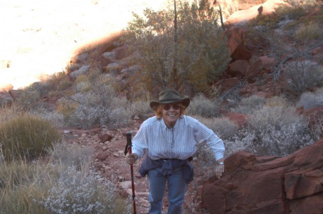
We did another walk nearer the campground, the Mparra Walk, which Marge said
gave her nightmares for days afterwards. It lead up, over a saddle, across
slanted rocks and narrow ledges and took two hours. Half way along she said to
me "you did know I am afraid of heights didn't you"?
We also used the Valley as a base to
visit Wallace Rockhole for an aboriginal interpretive walk and Hermannsburg,
the mission where Albert Namatjira did his painting.
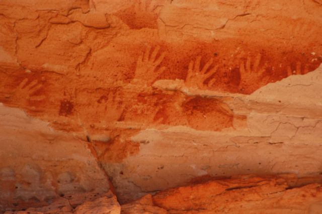
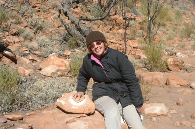
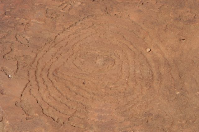
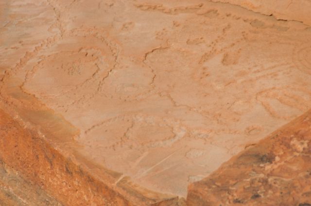
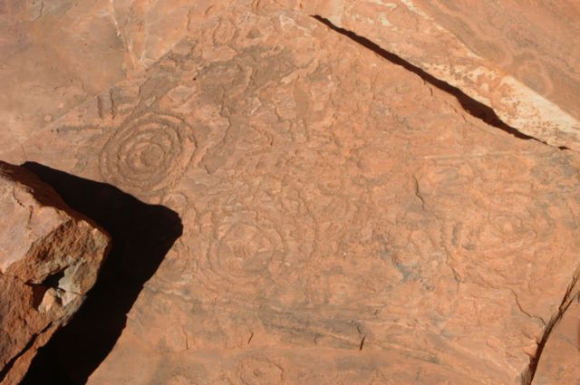
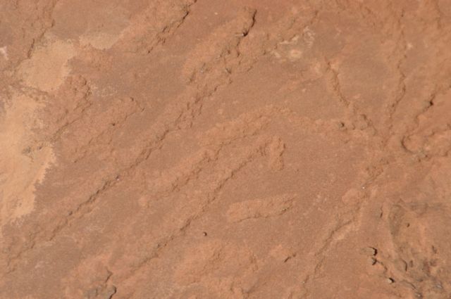
There were dozens of Engravings along the walk and a few Stencils like those
above. Along the way the locals had set up interpretive signs and had some
grinding rocks and hollows like the ones Marge is using where tourists were
encouraged to "give it a go".
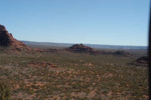
After we left Palm
Valley we headed along the
The Red Centre Way (formerly Mereenie Loop), kilometres of dirt and
corrugations, through native land, to visit King’s Canyon. The signs along
this rough dirt road were precious: “Lift ‘em up foot” (Slow down) and “Put
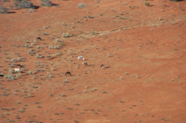
‘em down foot” (Speed up again). There were dozens of small herds of horses
(brumbies) in this area and most of them looked to be in pretty good
condition. Along the Merenie Loop, we suffered a chipped windscreen from an
oncoming car that barrelled along doing at least 120 km/hr, not bothering to
slow down or pull over when he saw us. (There was an open speed limit in NT at
the time which has since changed). I said a few choice words to him over the
UHF and others came back and agreed with my sentiments.
We didn’t stay at
King’s Canyon. On other’s recommendation, we went on to
King’s Creek Station which
is a few kilometres past King’s Canyon, but much friendlier and offers a
discount to NSW Senior’s Card holders (that's Marge, not me). Instead of
lining up the caravans in rows, there are semi- circular camping areas tucked
into the trees. Each had its own fire pit. We didn’t do the
King’s Canyon
Rim Walk, because it is a three hour walk with a big climb at the start
and Marge didn’t think her leg would make it (boy was I thankful for that).
|
|
|
|
|
|
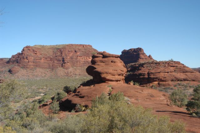
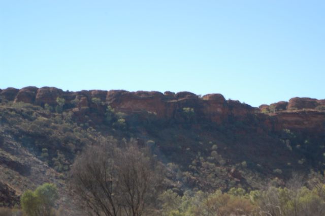
A View of
Kings Canyon
|
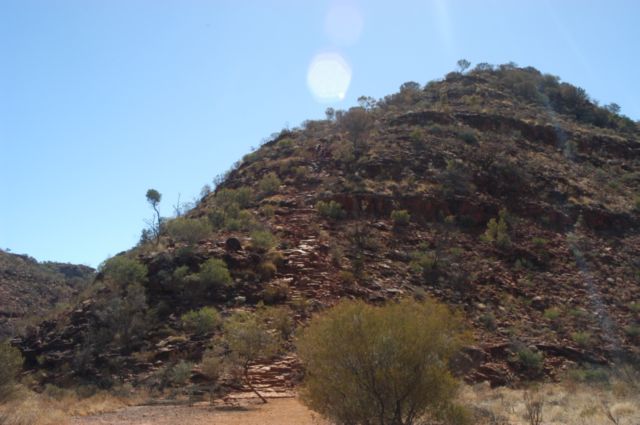
The steps up to
the Rim Walk at
Kings Canyon
|
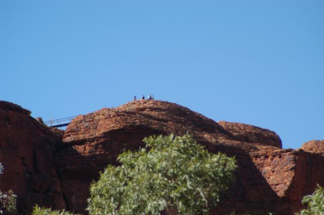
People standing on
the Rim at the top
of Kings Canyon
|
A wider view of
the previous shot
|
But we did walk into the canyon and
we did the
Kathleen Springs Walk. Signs along the track tell the story of centuries
of Aboriginal culture and the recent cattle industry. It leads to a delightful
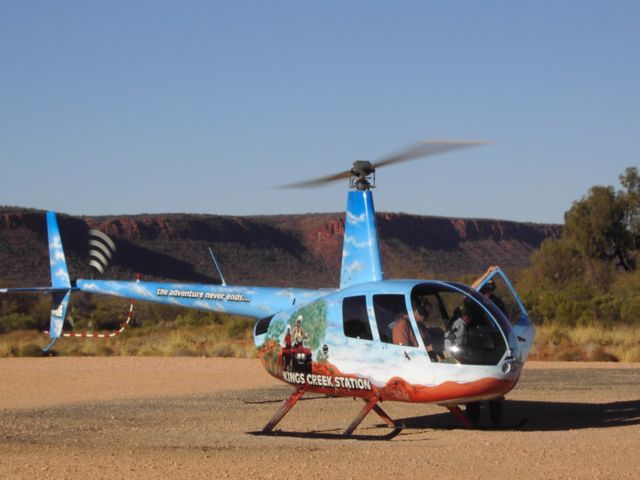
spring-fed waterhole at the head of Kathleen Gorge. We saw all there was to
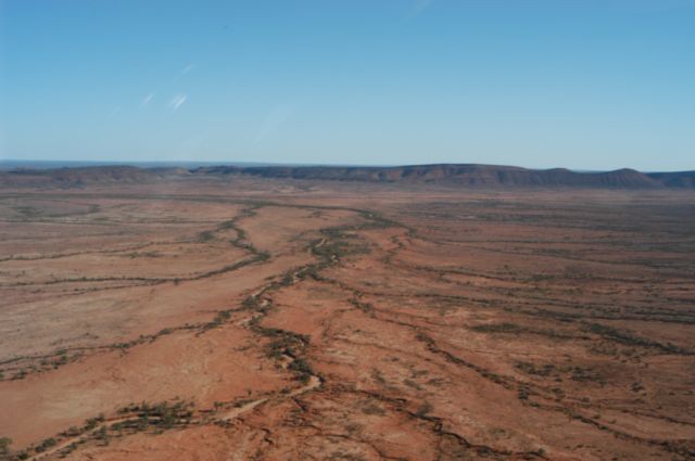
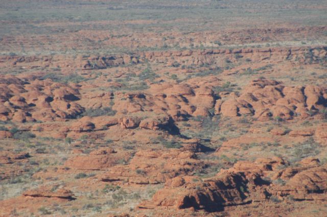
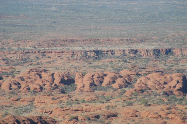
see on top from a helicopter ride which circled the King’s Canyon Rim Walk 3
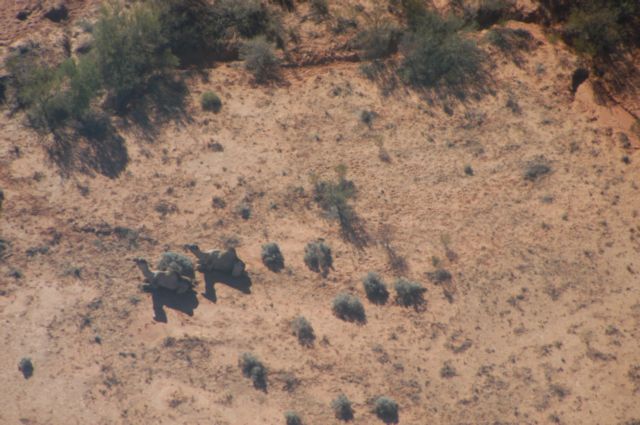
times and took us out over Petermann Pound and Aboriginal land looking for
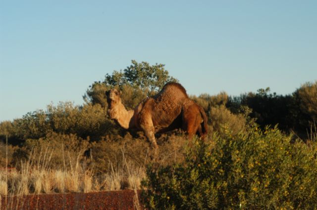
wildlife. “Wildlife” in the Red Centre appears to mean camels and horses. We
did not see one free-range kangaroo or emu while around southern N.T. While
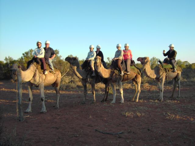
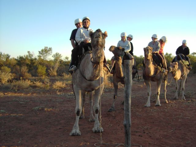
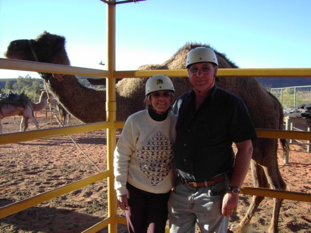
at King’s Creek, we rode camels at sunset, although Lofty seemed more
interested in eating bushes along the way. This area got the prize for the
most expensive petrol of the trip $1.86/ litre.
|
|
|
|
|
|
The chopper we flew in
|
Brumbies from Helicopter
at Kings Creek Station
|
Peterman Pound
|
Peterman Pound
|
|
|
|
|
|
|
Another view
from the chopper
|
Domes on top of
Kings Canyon
|
Domes on top of
Kings Canyon
|
Feral Camels
|
|
|
|
|
|
|
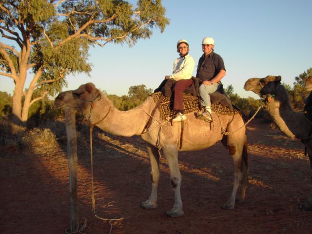
Greg & Marge on
the Camel Ride
|
Another Camel
Riding shot
|
Greg & Marge
on Lofty
|
Marge & Greg & Lofty
|
From Kings Creek
Station, it was a half-day’s drive to
Uluru (Ayer’s Rock).
We did not do the “grey nomad” thing and camp for free at
Curtin Springs. It is 85 Km away
from the Rock and we wanted to do sunrise and sunset.
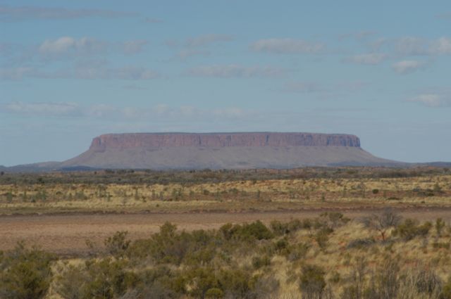
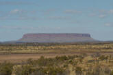
Along the Lasseter Highway about 11 km
east of Curtin Springs is a huge rock often mistaken for Uluru. It is
Mount Connor which can be viewed from a lookout on the side of the
highway.
 |
|
Mount Connor |
Lasseter Highway was
littered with equine road kill which was quite distressing to see. Eventually
we arrived at Yulara Camp
Ground, which was huge and crowded and expensive. We were placed about 200
meters from the nearest toilet and shower block, so we got into the habit of
riding our bikes there when we had to go. There were only two amenities blocks
in the campground and they managed to put two busloads of high school kids on
excursion next to each. We regularly showered either early morning or at 4 PM
so there was still hot water and we could get near a sink. I guess it is no
use complaining, where else can you camp within cooee of The Rock?
It was here at Yulara,
that I saw my first "WILD" Dingo of the trip. It was in the paddock behind the
Camp Ground and I suspect it is used to scavenging from around the tents and
rubbish bins. I was on my bike when I saw it, and of course I didn't have my
camera so I raced back to the Camper Trailer to get it but of course the dingo
knew that and was nowhere to be seen once I returned with the camera.
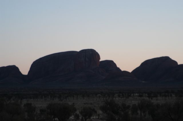
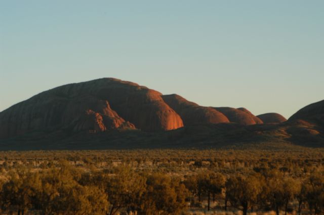
On day 2 we arose well
before dawn, and drove the 40 km to
Kata Tjuta (the
Olgas) to catch sunrise. As we arrived at the turn off into Kata Tjuta we
saw our first up close feral camel. The sunrise over Kata Tjuta was not all
that impressive as the sun did not really shine onto the side we were on.
After we had watched the sun rise over Kata Tjuta we did two walks, but it was
really cold and windy that early.
|
|
|
|
|
|
A feral camel
At Kata Tjuta.
|
Sun rise
at Kata Tjuta
|
The sun rising
over Kata Tjuta
|
Full sun
on Kata Tjuta
|
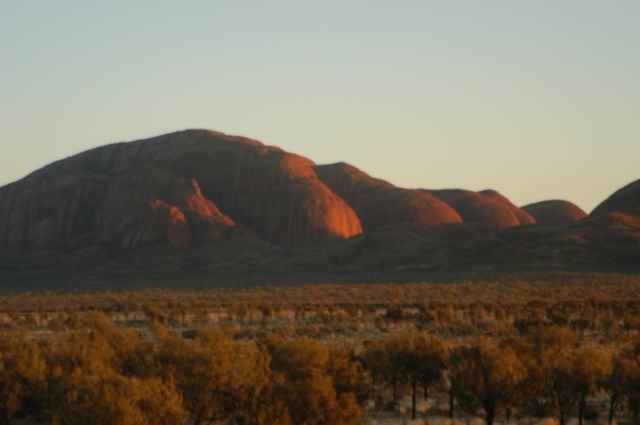
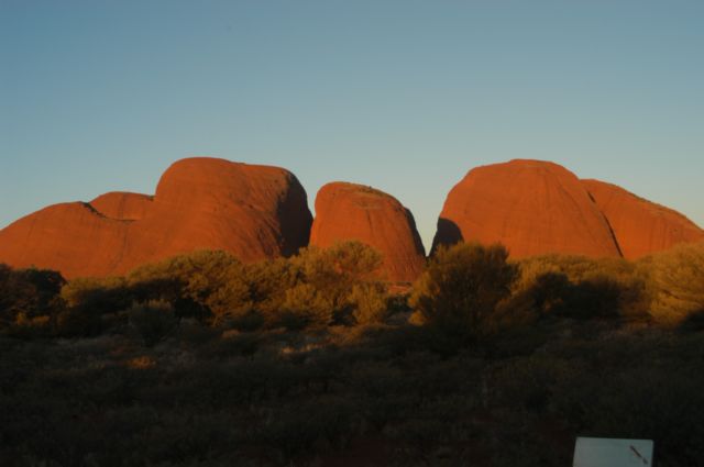
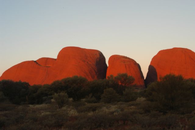
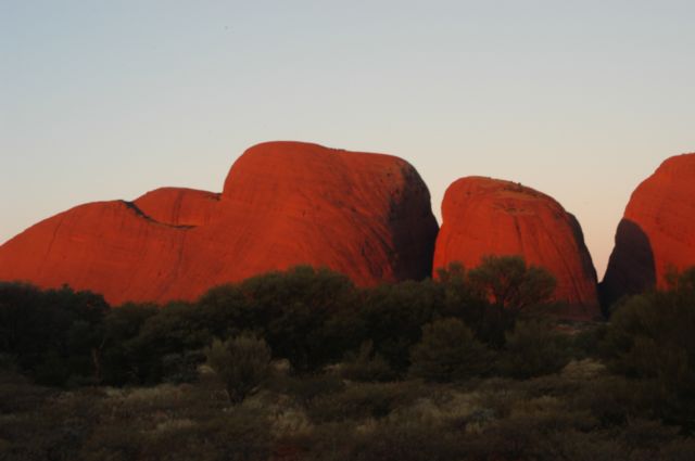
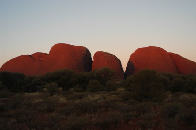
That evening we headed back to see
sunset. We parked on the other side of the range and it was a much more
impressive sight as the sun set.
|
|
|
|
|
|
Late afternoon
at Kata Tjuta
|
Kata Tjuta
as the sun is setting
|
The sun sets on the face
of Kata Tjuta
|
The sun has gone
from the face
of Kata Tjuta
|
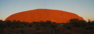
On our third day here, we got up
before daylight again and went to watch the sunrise on
Ayers Rock or Uluru,
and a pretty impressive sight it was!
 |
|
Uluru |
part three >>>>>

|
|