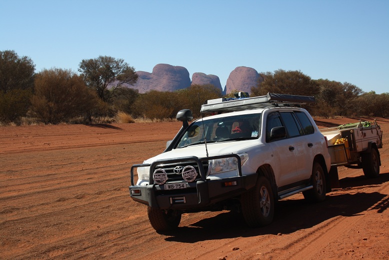
After having read Len Beadells book "Beating About The Bush", which is a
story about the construction of Sandy Blight Junction Road, I just had to go
see for myself. Early August my wife Erica, son Patrick and two great
friends Rick and Carroll set off to travel this track South to North. Rick
had his immaculate HJ80 Turbo and I had my New 200TTD Cruiser and Aussie
Swag Rover LX Camper Trailer. The 200 was replacing my faithful 80 series
and I was eager to put it to the test. I would not be disappointed.
 |
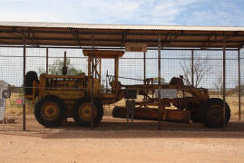 |
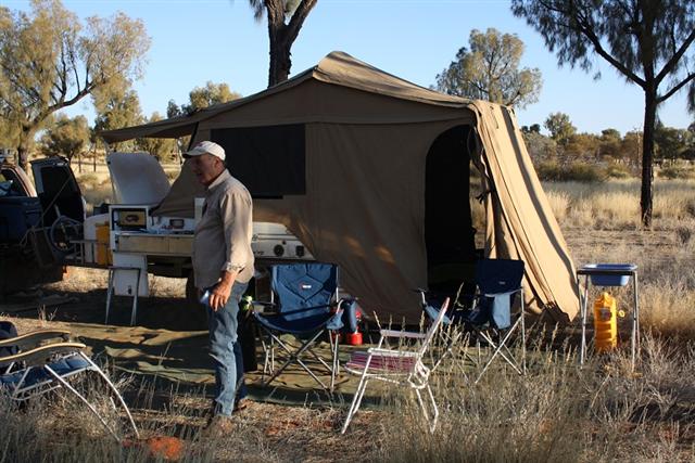
| |
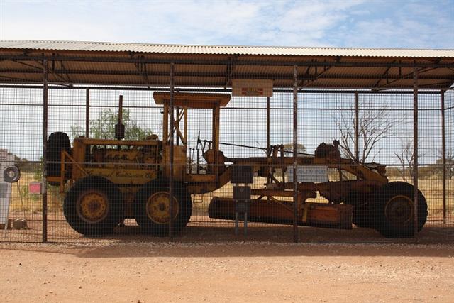
Len Beadells Grader located at Giles |
We set off from Newcastle and Rick from Sydney, we all
met up at Nyngan Caravan Park and headed for Cameron's Corner, Strzelecki
Track, Oodnadatta Track, Mulga Park Road around the back of Mt Connor to
Yulara For a day of rest and relaxation.
 |
 |
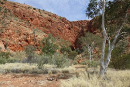
|
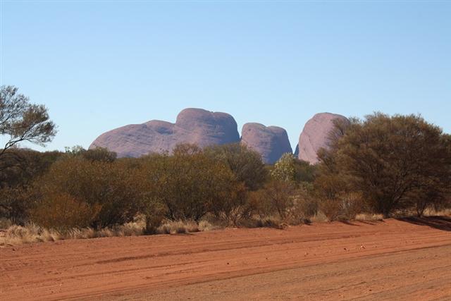
Great Central Road looking back at
the Olgas |
The roads so far were in fantastic condition with only
some corrugations, and the 200 handled these with out any discomfort. Rick
and I had swapped cars for about 30km just to compare if the 200 was any
better then the 80 series. Now I am a big 80s fan and lost considerable
sleep when considering purchasing the 200. The 80 immediately felt small
compared to the 200 and the engine noise!!! well you are certainly left in
no doubt that the old 6 cylinder oiler is doing its job, that's for sure.
I am sold, the 200 is a fantastic, comfortable, powerful, and most of all my
wife loved it.
After the rest we headed off across the Tjukururu Road (Great Central Road)
to Giles Meteorological Station and the Warakurna Road House for a refuel.
We then back tracked to the start of Sandy Blight Junction Road just west of
Docker River. The first 55km to the Tjukurla turn off is wide and smooth
although some patches are very sandy. After 27km the turn off to Bungabiddy
Rock Hole appears on your left. This road is narrow and rocky, at the end
there is a camp area and about a 300m walk to the rock hole.
 |
 |
|
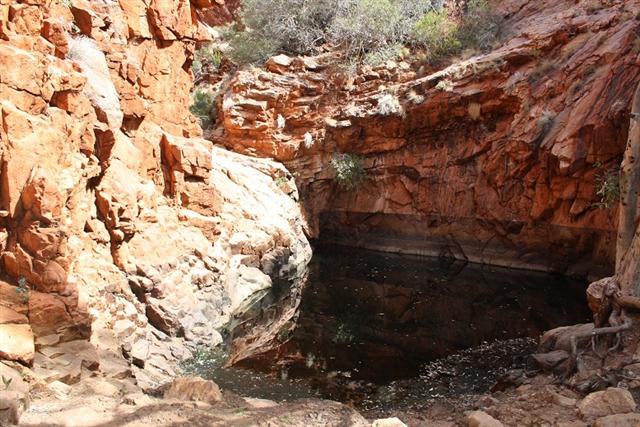
Bungabiddy Rock Hole |
|
 |
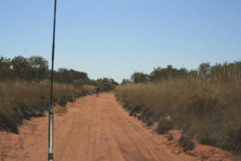 |
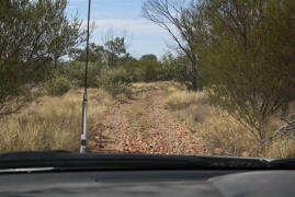
|
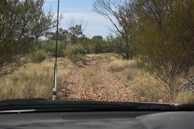
the track into Bungabiddy Sandy
Blight Junction Road |
After the Tjukurla Turn off the road narrows considerably
to a two wheel track, mostly sandy with some corrugations, generally easy
going and not difficult. Later on a couple of the sand hills present a small
challenge but no real problems. Beadell spent considerable time surveying
between the sand dunes and only has to cross them a couple of times. After
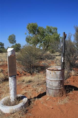
about 46km you come across one of several of Len Beadell's Plaque. We made
it a mission to locate all of his plaques and found all but the one that was
located at the junction Great Central Road and Giles Mulga Park Roads
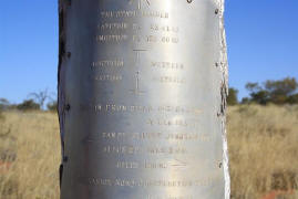 |
 |
|
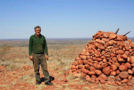
Len Beadell Plaque |
top of Sir Fredrick Range |
We did not know at the time
There is a book you can sign to say you have been there. That's a grubby
me after 3 days bush camping
After another 22 km there is a turn off to the left to
Sir Fredrick Range, it is hard to see and fortunately my in car Hema Maps
and Oz Explorer Navigation system was spot on. This road is overgrown and
very narrow there is a turn around spot at the end but even this requires
some backing and fiddling with the trailer. The girls took one look at the
track going up the range and said not going up there. I began to disconnect
the trailer as I wanted to try the 200 out in some serious stuff. However as
Rick and I were the only starters, I left the trailer on the 200 and we
proceeded in the reliable old 80. The first 800m had the old girl scrambling
for traction over the 6" round loose stones. If you get up this bit ok then
you will make it to the top, it gets easier but not much. The view from the
top is fantastic, you can see for hundreds of kilometres in all directions.
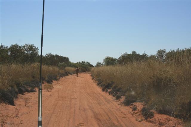
From here on the scenery gets better and better. The track becomes more
interesting and I thoroughly enjoyed the drive. There are some lovely
camping spots under the Desert Oaks and wonderful sunsets. There are many
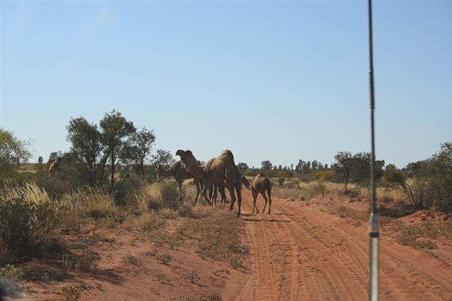
wild camels in this area and we came across several herds wandering along
the track.
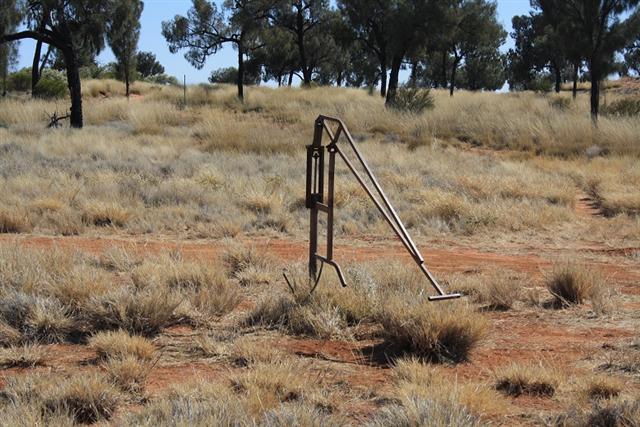
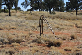
There are several bores along the
track we stopped at one with an operational hand pump and it delivered
clean fresh water. Certainly handy to know if you have a problem or just
want to have a freshen up.
 |
 |
|
operational pump |
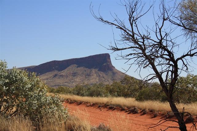
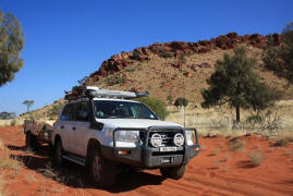
Davenport Hills |
The Track takes a slight detour around to the base of the
Davenport Hills instead of going up and over a medium sand hill. I elected
to take the detour as it took me closer to the hills.
Beadell then made a direct line for Me Leisler which can be seen in the
distance. Just before you reach Mt Leister you will come across another
Beadell Plaque and the Tietkens Tree, or at least what is left of it.
Tietkens was one of our early explorers and he blazed this tree on his
exploration of this area.
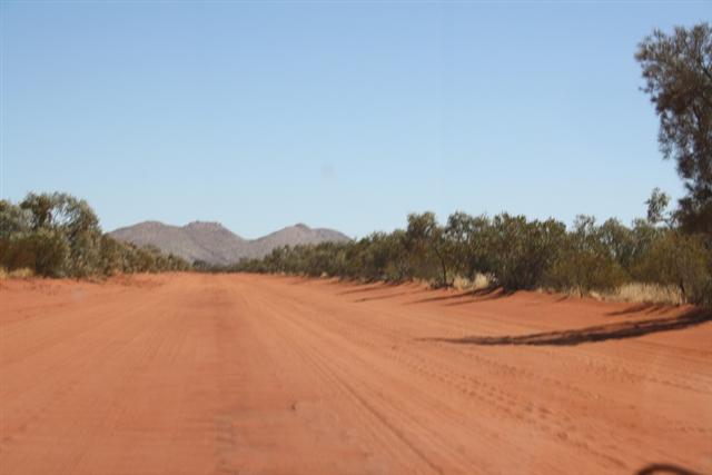
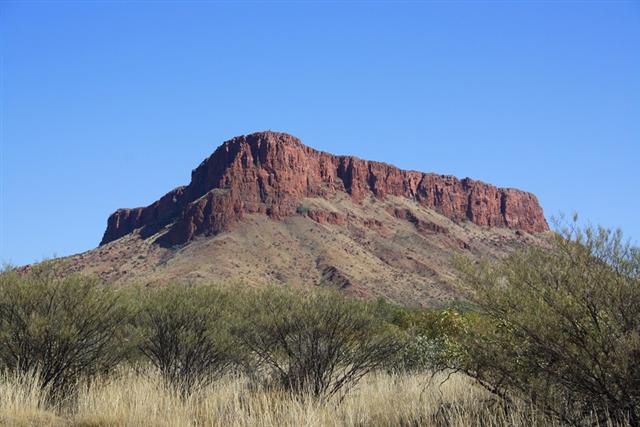
The track keeps east of the Kintor Range and Mt Strickalnd eventually coming
to the end at the intersection of Garry Junction Road. We turned right and
headed east towards Alice Springs. Garry Junction Road is 4 lanes wide and
was super smooth there are some nice scenery along the way to Papunya
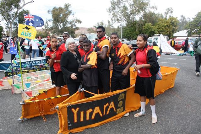
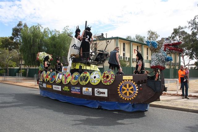
particularly around the Haasts Bluff. We arrived in Alice just in time for
the Todd River Regatta which is a series of boat races up and down the dry
sandy Todd River. The whole town turns out for this event.
After a couple of days rest in Alice we headed for home via Artunga. We
wanted to cut across to the Plenty Highway via Cattlewater Pass but it was
closed so we had to use Pinnacle Road which joins the Plenty Just east of
the Gem Tree. Whilst this is a roundabout way of getting to the plenty the
drive and scenery are well worth it.
So ends the adventure of Sandy Blight Junction. 332 km long accessible with
a soft roader 4 wheel drive such as an X trail or the like. You don't have
to go up Fredrick Range as this requires a vehicle with low range, other
wise it is a great trip.
article by Wayne and Erica Bell